From our first field season, KAMBE has integrated the use of remote sensing aimed at producing a high resolution, 3D record of the extant architecture exposed from earlier excavations at both Kalavasos Ayios Dhimitrios and Maroni Vournes. Check out some examples of our application of these technologies.
The Faro Focus X330, a 3D laser scanner used for surveying and 3D documentation, was used in our 2023 field season as a part of a study of architecture and ashlar masonry at KAD's Building X. Ashlar is characterized as rectangular cut stones worked toward a smooth surface. The assemblage of ashlar is moreover termed ashlar masonry, wherein blocks are fitted together to form one or more courses. In Late Bronze Age Cyprus, this process was mostly mortar-less and done by aligning narrowly carved joints. Coursed ashlar was reserved for the lower walls of buildings, and upper storeys would likely have been constructed with mudbrick or rubble masonry. Holes carved into orthostats—large ashlar blocks set up on their narrowest faces—also suggest that the stones might also have supported the wooden framework of a building’s superstructure. On Cyprus, ashlar blocks are also consistently made with limestone and sandstone, and often feature a depressed border around the outside of the block called a drafted margin. In KAD's Building X, ashlar lined the walls of various areas, including the western and northern Pithos Halls used for storing large quantities of olive oil, and the central hall. It was also employed for structural elements such as threshold blocks and door jambs.
PhD students Caroline Barnes (UBC) and Graham Braun (University of Cincinnati) used the Faro Focus scanner to produce high resolution visualizations of ashlar blocks, which after processing, reveal details of the stone working not visible in on-the-ground inspection. This facilitates comparisons with ashlar masonry from other Late Bronze Age sites, advancing our understanding of craft specialization and technological practices of the period. Barnes and Braun’s research also investigates the labor and time invested in constructing ashlar buildings, including Building X at KAD and the Ashlar Building at Maroni. This comprehensive study highlights the sophisticated masonry techniques of the era, and provides a deeper understanding of the cultural and technological networks in Late Bronze Age Cyprus.

Figure 1: Distance to Plane analysis (produced by G. Braun).
Distance-to-Plane analysis (Figure 1) of the laser scans demonstrates groupings of depth for multiple kinds of toolmarks, suggesting that more than one type of chisel was utilized for even the roughly worked regions of this block. These marks appear to come from multiple faces of the stone, suggesting that the face was worked in opposing directions. It is commonly understood that ashlar blocks were worked in situ, however, considering the proximity of this block to the foundation course, it is more likely that the face was chiseled when the stone was lying flat, in order to have enough room to chisel, and then erected upright.

Figure 2: Angle to Plane analysis (produced by G. Braun).
An Angle-to-Plane analysis (Figure 2) highlights patterns of stoneworking so that possible groupings of tool applications can be identified on discrete regions of this stone, even showing consistent directional percussion sessions that indicate the preplanning of drafted margins before even the rough cutting had begun.
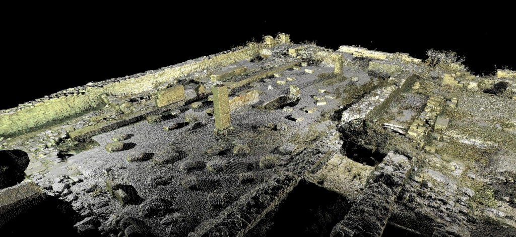
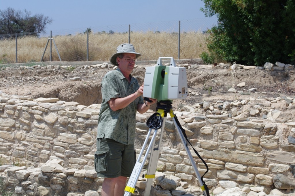
The Center for Advanced Spatial Technology’s Lecia ScanStation C10 allowed for a time-of-flight laser scanner, which captures the 3D coordinates (x, y, z) of points on a surface by measuring the time it takes a laser to hit its target and be reflected back to a sensor on the instrument (Figure 1). The C10 is considered a mid-range scanner (with a maximum range of 300 m) and is well-suited to recording architecture. The C10 has a scan rate of 50,000 points per second with accuracy in the +/- 4-6mm range (at 1-50 m) and also captures color data with an on-board digital camera. This is a form of LiDAR (Light Detection and Ranging), often referred to as terrestrial LiDAR to distinguish it from airborne applications. The laser scanner produces a representation of the scan target as a collection of points known as a "point cloud" (Figure 2). Using commercially available software packages (we use Leica’s Cyclone) the point cloud can be cleaned to remove any extraneous points (e.g. vegetation) and then joined (or “registered”) with other scans and a continuous surface (or "mesh") can be generated from the points using various algorithms. In addition to the utility of this 3D record as a cultural resource management tool, the 3D data can be imported into other software packages for further visualization, allowing us to (re?)construct the buildings in question, providing insight into patterns of movement and visibility in a Late Bronze Age built environment. The data can also be used to generate more traditional 2D top plans and sections.
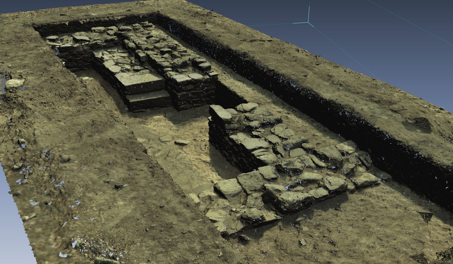
We also used the C10 to record the results of our test excavations at KAD. Figure 3 shows the point cloud generated by a series of eight Lecia C10 scans of the trench Unit 7 Test taken at the end of the 2012 field season.

Figure 2: Point cloud of the Pithos Hall at KAD, generated by the registration of three scans from the Leica C10 (Cyclone screen capture).

Figure 3: Point cloud of Unit 7 Test trench showing part of Building XVI at end of 2012 season, looking SE (Katie Simon).
